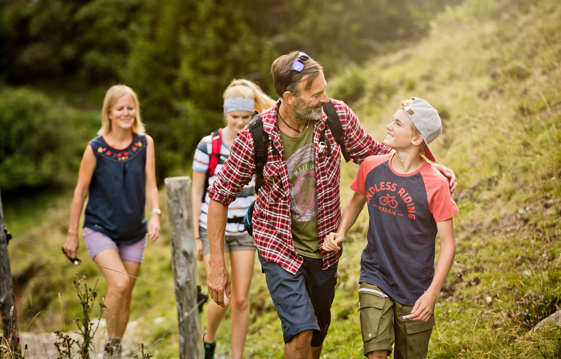
Hiking with children
Families experience the children's club's hiking and excursion program in summer 6 days a week.
For the little ones – alone or accompanied by their parents – we offer exciting adventure trails and easy hikes accompanied by our childcare staff.
Our "Bergfexn" team
Oldtimer Leni
- The Lengauerhof's "good soul" for many years
- Knows every path and every stone
- Specialist for stroller routes
Newcomer Edwin
- Supporting our outdoor team since 2022
- Always has an exciting story to tell
- Local hero from Leogang - knows every mountain
- Popular with young and old
Even moreover, every summer we offer an intern or holiday intern the opportunity to immerse themselves in the world of baby and childcare.
We hope you enjoy exploring the hikes in and around Saalbach-Hinterglemm!
Kids hiking challenge
Six ways - one challenge
The Kids Hiking Challenge is the perfect motivation for our little guests to go hiking and discover nature. There are a total of four themed trails and two mountain hikes to master; these will be noted on your hiking challenge pass using Zwick stations (the pass is available from us at reception). The program in the children's club also includes hiking challenge routes to help families collect points.
Once you have completed three routes, you can hand in the pass at our reception in exchange for a certificate and the medal. Our mascot Lengi comes to visit the children at dinner to hand out the deserved awards.
Hiking challenge for adults
Pretty wide, pretty casual! Three long-distance hiking trails - one challenge: a total of 64 kilometers and 3,800 meters of climbing have to be conquered in the Saalbach Hiking Challenge in the Home of Lässig. Anyone who completes the Pinzgauer Walk, the Seven Summits of Saalbach Hinterglemm and the Home of Lässig Walk can collect a personal trophy from the tourism association.
The principle is the same as the Kids Challenge. The control cards are available at reception and the individual stages of the hikes are noted in the pass.
Guided hiking tours
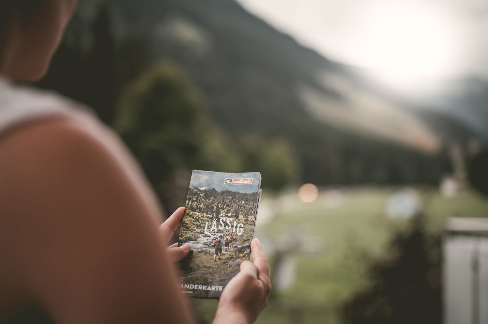
If you and your family are looking for endless hiking trails, picturesque mountain lakes, deep green forests and breathtaking panoramas, Saalbach Hinterglemm Leogang Fieberbrunn is the right place for you. In summer, over 400 kilometers of well-signposted hiking trails await fit mountain enthusiasts, leisurely walkers, persistent long-distance hikers and motivated families. With the interactive hiking map in the Home of Lässig app you can easily find your way around the various routes.
Saalbach Hinterglemm also offers free guided hikes with certified hiking guides. You can find these on the Saalbach Hinterglemm homepage.
Home of Lässig Walk
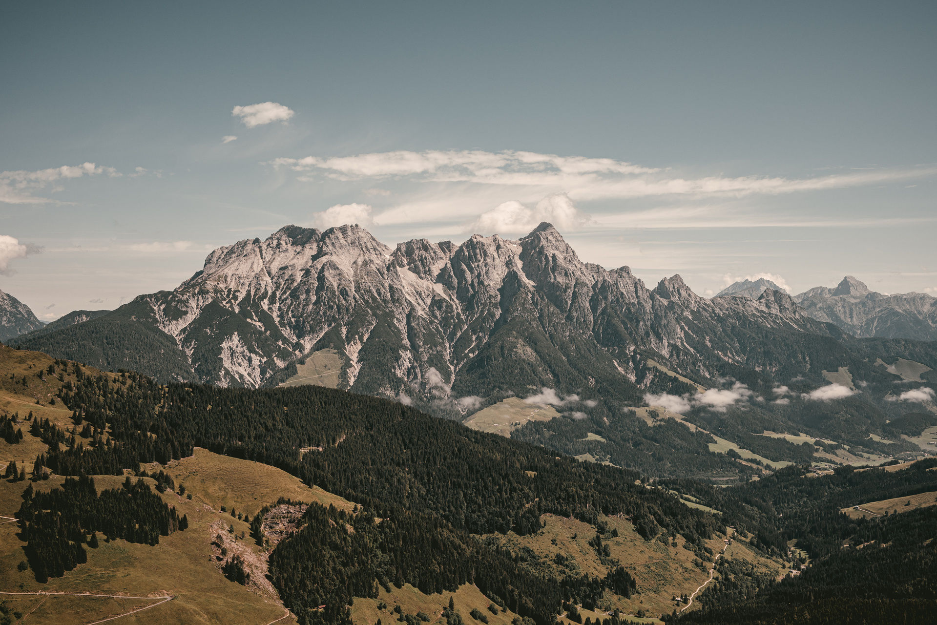
With around 1,700 meters in altitude, 5 peaks and around 22 kilometers, the “Home of Lässig” walk leads right into the middle of a real nature experience. The Hinterglemm valley head is an ideal retreat for hikers – far from all lifts and bike trails. Although the route includes a few peaks that are very popular, especially among the locals, you are guaranteed to find peace and quiet and a few lonely moments on this U-shaped tour in the valley basin. Here is the kingdom of chamois, marmots, deer and a pair of golden eagles can often be seen hunting for prey over the rocky walls.
From the Lengau parking spot you can take a leisurely walk to warm up to the Lindlingalm. Here, after about 200 m, you branch left up over Birgl to the Schusterscharte. The path is steep at 1,985 m above sea level, but you have mastered a large portion of the altitude difference on this tour right at the beginning. The climb is also in the shade – a big advantage on summer tours. From the Schusterscharte you can recharge your batteries because the route is relatively flat over a beautiful plateau to Mittagskogel and then even downhill to the gate. Well recovered, you can now tackle the next steep climb to the Teufelssprung. The view is legendary from this rocky place where, according to legend, the devil fought a showdown with the local dairymen. Here, after about 4 hours of walking, we recommend taking a short break to regain your strength and have a snack before you get to what is probably the most beautiful part of the hike.
Seven Summits
A special challenge awaits all fit, sure-footed and experienced mountain hikers: the SEVEN SUMMITS of Saalbach Hinterglemm. This almost 24 km long mountain tour over the highest peaks of the Glemmtal, with an alpine character and 1,450 meters in altitude, is a tour for hardened individualists and physically fit alpinists.
The signposted route leads via Stemmerkogel and Hochkogel to what is probably the most technically demanding climb to the Hochsaalbachkogel. We continue via Bärensteigkogel, Manlitzkogel and Mittagskogel to the final highlight and highest mountain in the Glemmtal, the Geißstein at 2,363 m. Reserves of strength should also be planned for the difficult descent over the Birgel into the head of the valley. There are no serviced huts along this route. This requires good preparation: you should only tackle this tour with perfect equipment, enough provisions and water in your backpack, and tour planning with regard to the weather and early descent options.
Pinzgau walk
Don't let the term "walk" fool you, because it's quite something. This long-distance hike from Saalbach to Zell am See on one of the most beautiful high-altitude trails in the Eastern Alps should be on the to-do list of every passionate hiker. This hike requires a good level of fitness, but the tired legs are definitely worth it.
The hiking guide Hans Adelsberger goes on this classic hike with the guests once a week and knows that it is important to always have enough provisions and drinks with you in your backpack. The hike also starts very early, as the distance of almost 18 kilometers should not be underestimated.
Along the beautiful path you can look into the Hohe Tauern and let the Glockner group sink in. At the Schmittenhöhe in Zell am See there is the final highlight of the six-hour march: the view of Lake Zell and the Hundstein. Afterwards you take the gondola down into the valley to protect your knees.
The path near the ridge is at an altitude of between 1,900 and 2,000 meters and is therefore beautiful to walk even on hot summer days.
Saalachtaler Höhenweg
If you have a bit of stamina and love beautiful views, you shouldn't miss this classic hiking route. After a leisurely mountain ride on the Asitzbahn, around 15 kilometers of hiking trails await you on the western part of the Saalachtaler Höhenweg. After climbing the Großer Asitz, you continue hiking to the Schönleitenhütte and back up to the Wildenkarhütte. Then it goes alternately through forest and meadows down to Spielbergtörl. If you still have enough motivation and stamina, you can tackle the somewhat steep climb to the Sielberghorn. Afterwards everyone continues the hike down to the Spielbergalmen, where everyone has earned a snack on the Lindlalm and can enjoy it.
When the weather is nice, the peaks of the Leoganger Steinberge, the Steinerne Meer and the Hohe Tauern shine particularly impressively. With a bit of luck you can also see Austria's highest, the Großglockner, and Salzburg's highest, the Großvenediger.
The hiking guide Edi Hammerschmied has been leading guests on the most beautiful routes around Leogang for over 20 years. With it, hikes are not just hikes, but you also learn a lot of interesting facts about trees, mushrooms and the history of Leogang as you descend from the mountain. This guided hike is also suitable for families if the children are a little older and can manage the 4.5 hour walk.
Trailrunning
Running over hill and dale
Your terrain begins where the paved road ends. Every run is an adventure and behind every bend on the narrow path there are impressive views and untouched nature. The trail runners conquer the high-altitude hiking trails and find an almost inexhaustible training area with the seal of quality “extremely worth running”.
When trail running, the percentage of ascent in altitude is at least 5% of the total distance compared to running on the flat. Trail running routes do not run on asphalt and the proportion of gravel roads is reduced as much as possible. Anyone who has ever indulged in the fascination of trail running knows that the “runner’s high” is redefined in mountain running.
Trail running requires full concentration and ability to react. The runners have to be able to nimbly avoid the slippery roots and at the same time tap into their energy reserves for the next climb. Running on the mountain is certainly not monotonous, like a training session on endless asphalt roads, because constantly changing surfaces add momentum to your running style. This natural adventure on naturally grown ground not only demands strength and stability from your muscles, but also clears your head and your lungs fill with clear mountain air. This will certainly put a satisfied grin on everyone's face.
Beginner trails and marathon routes
The Saalbach Hinterglemm Leogang Fieberbrunn region offers easy routes for beginners, where you can overcome the first few meters of altitude with little effort on the fast summer cable cars and then enjoy the panorama on moderate inclines up to the summit. But marathon distances for hard-core endurance runners can also be found on the interactive trail running map. If you want to protect your knees, you have the opportunity to comfortably complete the route back to the valley using the operating cable cars on many tours. The signature trail and highlight of the mountain running scene is certainly the JOKER Trail Run. Here you should keep your JOKER CARD to hand, because four summer cable cars can be used as a free ascent aid when running on four mountains.